Geopacks
Scotland Parliamentary Map
Scotland Parliamentary Map
SKU:BESPARLSCO
Couldn't load pickup availability
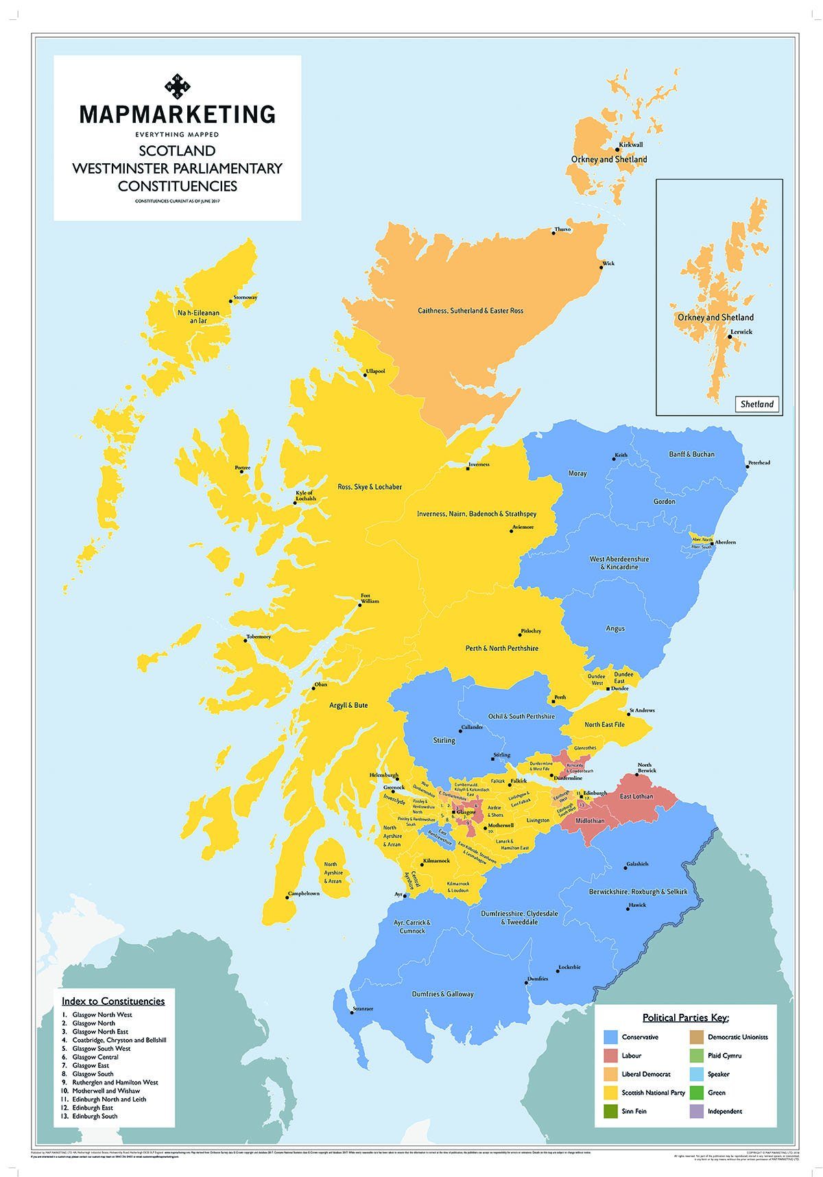
This map shows all electoral areas in Scotland, colour-coded to show the elected party for that constituency in 2017. The text has been carefully resized to fit within each boundary creating a clear and accurate map. This Scotland Parliamentary Constituencies wall map has an easy to use numbered index for each constituency as well as a colour-coded legend for each of the elected parties. 
Available in 4 different framing styles, black, dark wood and light wood, or Aluminium with metal backing which allows for magnets to be placed on to the map. Also available as a repositionable and self adhesive wall paper (please do not use wall paper glue for this, the wall paper map is self adhesive)
Map Features
- A clear and accurate map
- Easy to use numbered index
- Colour-coded legend giving a visual reference for the political parties seats across Scotland.
This colourful map is an ideal visual reference for anyone needing to see the distribution of political parties across Scotland.
Dimensions:
83cm x 120cm (32.6 x 47.2 inches)