Map Sherpa
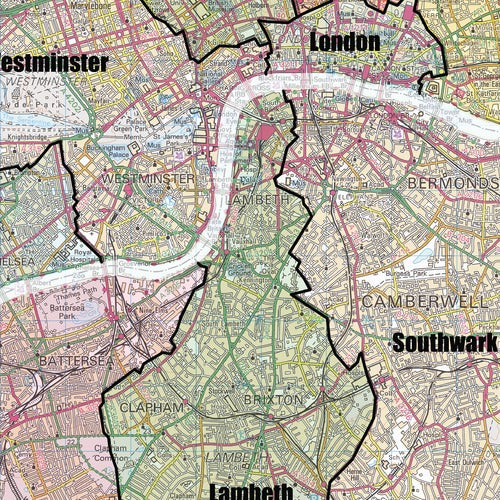
Greater London Authority Boroughs Wall Map
Greater London Authority Boroughs Wall Map
SKU:MS-GLOND-R
Stay organised and gain a clear view of London's administrative boundaries with this detailed Greater London Authority Boroughs Wall Map.
Designed for businesses, schools and public sector organisations, it provides a comprehensive reference of all London boroughs set against a clear and informative background mapping.
Ideal for planning, sales territories, logistics, transport analysis, education and regional research, this map makes it easy to identify borough boundaries and understand the wider Greater London area at a glance.
The front laminated version features a durable glossy finish, allowing you to write directly onto the map with dry-erase markers. Highlight key locations, mark routes, plan projects or share important information, then simply wipe clean and update as required. The lamination also provides extra durability, helping to protect the map from creases, tears and everyday wear.
Printed to a scale of 1:58,000, this high-quality wall map is a practical addition to offices, classrooms, meeting rooms and operational planning spaces. Each map is carefully rolled and packaged in a sturdy protective tube to ensure it arrives in excellent condition.
Available formats:
- Rolled wall map
- Front laminated wall map
A valuable reference tool for businesses, local authorities, schools and organisations needing a clear and reliable overview of Greater London's borough boundaries.
Couldn't load pickup availability
Share