Map Sherpa
North America Wall Map - Atlas of Canada
North America Wall Map - Atlas of Canada
SKU:MS-NAMER
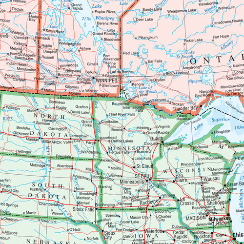
Discover North America in impressive detail with this comprehensive North America Wall Map, ideal for businesses, schools, colleges and organisations looking for a reliable and informative map reference.
Produced at a scale of 1:10,000,000, this high-quality map provides extensive coverage of the continent, clearly showing countries, dependencies, cities, towns, transportation networks and major drainage systems. Colour-coded countries make it easy to distinguish borders and understand the geography of the region at a glance.
Packed with useful reference information, the map also includes three inset maps featuring the Aleutian Islands (Alaska), Hawaii, and a relief map of North America highlighting significant mountain elevations. A handy road mileage table between major cities provides additional value for planning, education and regional analysis.
The front laminated version is finished with a durable high-gloss coating, allowing you to write directly onto the map using dry-erase markers. Mark routes, highlight key locations, support presentations or create planning zones, then simply wipe clean and reuse. The robust lamination also helps protect against tears, creases and everyday wear, making it ideal for busy offices and classrooms.
Whether used for teaching geography, business planning, logistics, travel planning or general reference, this map is a practical and attractive addition to any workspace or learning environment.
Each map is carefully rolled and packaged in a sturdy protective tube to ensure it arrives in excellent condition.
Features:
- Scale: 1:10,000,000
- Detailed political and physical reference mapping
- Colour-coded countries and dependencies
- Major cities, transport routes and drainage networks shown
- Inset maps of the Aleutian Islands, Hawaii and North America relief
- Road mileage table between major cities
- Available as a rolled or front laminated wall map
- Suitable for dry-erase marker use on laminated versions
A versatile mapping resource for schools, universities, offices, logistics teams and anyone needing a clear overview of North America.
Couldn't load pickup availability
Share