Map Sherpa
Scotland Executive Wall Map
Scotland Executive Wall Map
SKU:MS-SCOTEX
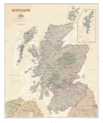
Explore Scotland in exceptional detail with National Geographic's Executive Wall Map of Scotland, one of the largest and most comprehensive maps of the country available. Combining authoritative cartography with elegant design, it is an excellent addition to schools, offices, meeting rooms and public spaces.
Featuring a sophisticated antique-style colour palette and beautifully shaded relief, this map showcases Scotland's dramatic landscapes while providing a clear and informative reference resource. Hundreds of locations are identified, including major cities, towns, counties, political boundaries, key transport infrastructure and selected historical sites.
The map covers the whole of Scotland, from the rugged Highlands and Southern Uplands to the stunning Isle of Skye, Inner and Outer Hebrides, and the Orkney Islands. The Shetland Islands are included in a dedicated inset map, ensuring complete national coverage. Scotland's nine political council areas are also clearly marked, making this map particularly useful for education, business planning and regional reference.
Available as a front laminated wall map, the glossy write-on, wipe-off finish allows you to use dry-erase markers to highlight locations, plan routes, track projects or support presentations. The durable lamination helps protect the map from everyday wear and tear, resisting creases, folds and rips for long-lasting use.
Produced at a scale of 1:650,000, this attractive and practical map balances detailed information with impressive visual appeal.
Each map is carefully rolled and packaged in a sturdy protective tube to ensure it arrives in perfect condition.
Features:
- Scale: 1:650,000
- One of National Geographic's largest and most detailed maps of Scotland
- Antique-style colouring with attractive shaded relief
- Shows hundreds of cities, towns, counties and key locations
- Includes political boundaries, infrastructure and selected historical sites
- Complete coverage of mainland Scotland and surrounding islands
- Shetland Islands included in a dedicated inset map
- Clearly identifies Scotland's council areas
- Front laminated option suitable for dry-erase marker use
- Durable, tear-resistant finish
- Supplied rolled in a protective tube
- A standout reference map for schools, businesses, local authorities and anyone with an interest in Scotland's geography, history and landscape.
Couldn't load pickup availability
Share