Map Sherpa
World Classic Wall Map
World Classic Wall Map
SKU:MS-WORCLA
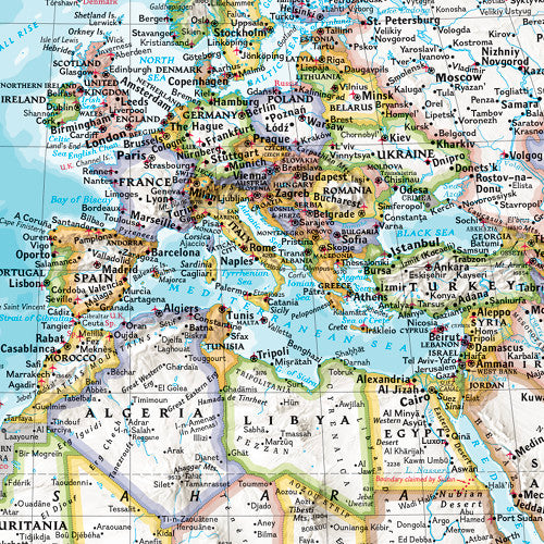
Discover the world with confidence using National Geographic's Classic World Wall Map, a trusted reference map renowned for its accuracy, clarity and exceptional cartographic detail.
Widely regarded as the benchmark for world mapping, it is an outstanding resource for schools, businesses, offices and anyone with an interest in global geography.
Meticulously researched and independently produced using multiple authoritative sources, this map presents the world in National Geographic's iconic Classic style. Bright, easy-to-read colours, rich blue oceans and beautifully shaded relief combine to create a visually striking map that has been a hallmark of National Geographic cartography for more than 75 years.
Created using the Winkel Tripel projection, the map minimises many of the distortions commonly found in world maps, providing a more balanced representation of the Earth's landmasses. This means countries and continents are displayed in more realistic proportions, helping users gain a better understanding of global geography.
Thousands of place names are carefully positioned to maximise readability, even in densely populated regions such as Europe, Asia and the Middle East. The map clearly identifies international boundaries, major cities, rivers, mountain ranges, physical features and ocean floor formations, making it ideal for education, research and everyday reference.
Additional inset maps provide valuable insights into:
Global vegetation and land use
Population density
The North Polar Region
The South Polar Region
Designed in a convenient poster format, this map delivers an impressive level of detail while fitting comfortably into classrooms, offices, libraries and study spaces. It is sized to fit standard poster frames, making display and installation simple and professional.
Printed on quality paper and supplied folded, the map is ideal for quick reference, educational use or display. Each copy is packaged in a sturdy cardboard-backed envelope to help ensure it arrives in excellent condition.
Features:
- Scale: 1:37,213,000
- National Geographic's renowned Classic World Map design
- Winkel Tripel projection for reduced map distortion
- Bright colours and detailed shaded relief
- Clearly marked countries, cities, rivers and physical features
- Detailed ocean floor and geographic information
- Inset maps showing vegetation, land use, population density and polar regions
- Poster-sized format suitable for homes, schools and workplaces
- Folded paper map supplied in a protective cardboard-backed envelope
A superb educational and reference resource for classrooms, libraries, meeting rooms and workspaces, helping users explore and better understand the world around them.
Couldn't load pickup availability
Share